MANHOLE & CHAMBER INSPECTION · OFFLINE · CLIENT-READY

The fastest way
to inspect what's
beneath your streets.

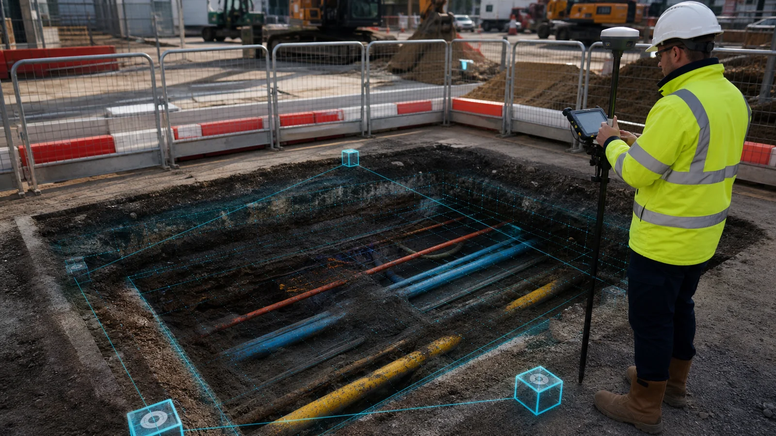
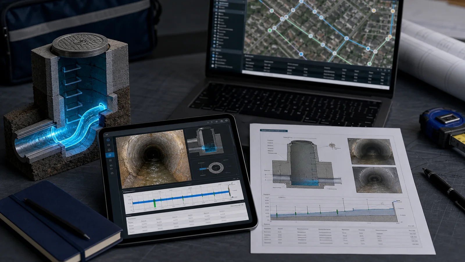
Capture in the field. Validate in the office. Hand over a complete digital twin with PDF, DXF, KML, CSV, photos and interactive 3D.

Works offline
14-day trial
No credit card
One record, every output
FIELD CAPTUREOFFICE QACLIENT HANDOVER
01 · REAL-WORLD

Cover on pavement — exactly what your crew photographs on site.

Interactive 3D manhole inspection model. Drag to rotate, scroll to switch between real-world, structural model, cutaway and exploded views. Use the workflow section below for an accessible step-by-step description.
REAL-WORLD VIEW
ASSETMH-247
REAL
MODEL
CUTAWAY
EXPLODED
Interactive 3D inspection chamber model showing cover, frame, body, invert, sump and pipes. Drag to rotate, scroll to explode the components.
IC RECTANGULAR CHAMBER
ASSETIC-118
REAL
MODEL
CUTAWAY
EXPLODED
Offline
Capture on site
One record
Field to client
QA gate
Before publish
PDF · CAD · GIS
One handover pack

Built for UK utility & infrastructure delivery teams

Before → After
Manual notes + photo chaos
Structured capture with instant asset timeline and publish-ready records.
Before → After
Office waiting for field updates
Live status map and feed so PMs see progress in real time.
Before → After
Slow handover to clients
One-click publish unlocks PDF/KML/DXF/CSV + portal in minutes.

Features

Too many tools, too much rework, slow handover.

myPitLab gives one flow for field capture, office QA and client delivery — without spreadsheet chasing.

Field
Capture inspections once, even offline, and sync automatically when signal returns.
No data re-entry
Office
QA, approve and publish from one dashboard with live status across every asset.
One review view
Client Portal
Share one secure project view with reports, maps and exports ready for handover.
10 export formats

Workflow

From site visit to handover in 4 clear steps.

Technical validation, standards and QA happen here, not in the hero copy.

STEP 01
Capture on site
Scan asset, add photos and structured readings from mobile forms.
STEP 02
Auto-check quality
System flags missing data, applies standards and prepares QA review.
STEP 03
Approve and publish
Office teams validate once and lock the inspection record.
STEP 04
Deliver outputs
Generate reports, CAD/GIS exports and client-ready links instantly.

Live product story

From real-world asset to a verified digital twin.

Explore the same chain your team uses: LiDAR and photos in the field, coordinate and scale QA in the office, then a complete client handover.

PHOTO PIN · 01Inlet A225 mm VCP · invert 1.86 m
FIELD · SMART CAPTURE

Capture once, even offline.

LiDAR, photos, GPS and structured readings stay attached to one asset from the first site visit.

LiDAR + camera capture
Automatic phone coordinates
Offline queue with conflict protection
12CAPTURED PHOTOS
±18 mmMODEL SCALE QA
One evidence chainThe pins, dimensions, QA state and handover preview below all refer to the same sample asset: MH-247.
FIELD PHOTO · MH-247VERIFIED TWIN · MH-247

Drag from field evidence to verified twin

The same asset, angle and pipe geometry — source imagery stays attached to the measured model and final handover.

12 SOURCE PHOTOS3 GROUND CONTROL POINTS±18 MM SCALE QA
CLIENT PORTAL · LIVE PROJECT
Utilities Framework 042
● SYNCED
MH-247Published · Good
IC-118QA review · Silt
TP-024Captured · Offline

Exports

One verified record. Every client output.

The MH-247 data shown in the product story flows into the report, CAD, GIS and structured exports below — without rebuilding the record.


Product sample, clearly labelledThe values below demonstrate the output structure. Your own templates, fields, coordinate system and branding are configurable.
PDF
PDF Report
Per inspection · Custom template · A4
IN PACK
HTML
HTML Report
Per inspection · Web-ready
IN PACK
KML
KML / KMZ
Per project · Google Earth · GIS-ready
IN PACK
DXF
DXF 2D + 3D
CAD-ready · Layered · AutoCAD compatible
IN PACK
SVG
SVG / PNG Diagrams
Vector · Print-quality · Watermarked
IN PACK
CSV
CSV Data Export
Excel · GIS · ETL-ready
IN PACK
ZIP
Project Bundle
All formats · One download · Client-ready
ONE CLICK
myPitLab
Inspection Report · v1.0
PUBLISHED
ASSET CODE
MH-247
2.40mChamber depth
TypeManhole · Foul
Cover Level+12.85m AOD
Water Depth0.08m
Silt Depth0.05m
ConditionGood (WRc 2)
MaterialBrick / Benched
Pipe Connections
INN · 225mm VCP1.85m
INE · 150mm VCP2.10m
OUTS · 300mm RC2.25m
↓ PDF
↓ KML
↓ DXF
↓ CSV

Coverage

Launching UK first, then expanding.

UK manhole workflow is live now. Country standards, units and defect libraries for other markets are rolling out next.

🇬🇧United Kingdom
🇮🇪IrelandSOON
🇦🇺AustraliaSOON
🇳🇿New ZealandSOON
🇺🇸United StatesSOON
🇨🇦CanadaSOON
🇩🇪GermanySOON
🇳🇱NetherlandsSOON
🇫🇷FranceSOON
🇿🇦South AfricaSOON

Prove it on your workflow

Run one inspection. Verify the whole chain.

No generic sales claims. Use a real asset, follow it from field capture through QA, and judge the client handover yourself.

Your first-project proof checklist

A practical pilot for drainage, highways, water, civils and survey teams.

01 · Capture offline
02 · Sync the record
03 · Run office QA
04 · Publish once
05 · Check CAD / GIS
06 · Share with client
Run a guided pilot

What you should verify

Three operational promises that should survive contact with a real project.

  • One publish, full pack — PDF, DXF, KML and CSV come out of a single flow.
  • Offline-first capture — capture and edit without a connection, then sync when signal returns. Sign-in, sync and export need connectivity.
  • One source of truth — field, office and client always see the same record.

FAQ

Answers teams ask before rollout.

Does it work with poor signal on site?
Yes. Field capture is offline-capable and syncs automatically when connection returns.
Can clients access progress without app login?
Yes. You can share secure workspace links with published inspections and exports.
How fast can we onboard a team?
Setup is guided end to end: users and roles, report templates, asset imports and a first-survey check. You can work through it yourself or book a walkthrough with us.
Can we map to our own standards?
Yes. Coordinate systems, inspection standards and report outputs are configurable.

Roadmap

UK is live. Global + mobile is next.

Built as UK-first for manhole inspections, then expanded market by market with local standards and mobile apps.

UK manhole workflow (live)
Production-ready inspections, publish flow, exports and client-ready deliverables.
Ireland / Australia rollout (next)
Localized standards, unit defaults and defect dictionaries tuned for each market.
US / EU market packs (later)
Country-specific presets, QA rules and reporting templates for larger frameworks.
Mobile apps are coming soon
Native apps for Android and iOS are in progress. Join the early-access list to get notified first.
Android app - coming soon
iOS app - coming soon
No spam. Product updates only.
Insights

Practical guides for survey teams

Long-form notes on manhole surveys, STC25, client portals, monitoring, and running a modern UK survey firm — written for operators, not buzzwords.

Prove it on one asset.
Then scale the workflow.

Start free in your browser, or run a guided pilot using one of your own inspection records.

Start free Run a guided pilot View pricing

support@mypitlab.com · mypitlab.com

myPitLab Start free