By the myPitLab team · Last updated 8 July 2026 · 5 min read
TL;DR
- UK drainage and highways jobs include gullies (GY) as well as MH and IC — treating them as an afterthought in generic forms creates rework
- Gully surveys need grate dimensions, pit depth, water/silt levels and outlet pipe data — different fields than manhole chambers
- The same workflow applies: offline capture → QA → PDF, portal, DXF and KML
- 3D visualisation helps clients understand grate, pit and outlet geometry without hand sketches
- One platform for MH, IC and GY beats three spreadsheets on the same job

Key takeaways
- Gullies are first-class assets, not a checkbox on an MH sheet
- Grate shape (circular, square, rectangular) drives valid dimension fields
- Water and silt depth matter for maintenance prioritisation and client reports
- Outlet pipe angle and invert link to network connectivity — same discipline as MH pipes
- Publish gully records through the same client portal as chambers
In this article
- Why gullies need their own capture form
- Fields UK clients expect on gully surveys
- 3D gully models vs flat sketches
- Gullies in the same job as MH and PAS128 work
- Workflow from field to deliverable
- Frequently asked questions
Introduction
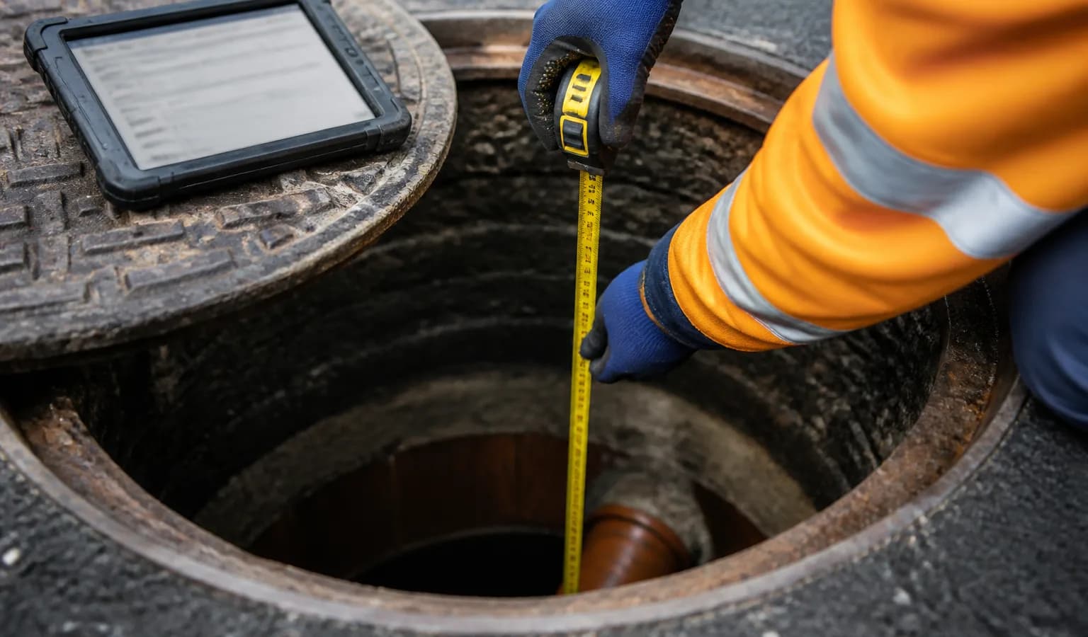
A highways drainage run might log 200 gullies and 30 manholes on the same shift. If your software forces gullies into an MH template, surveyors leave pit depth blank, skip outlet angle, or store grate size in free text nobody can query later.
Council and developer adoptable drainage schedules list GY assets with the same rigour as MH-### codes. Framework clients expect gully data in GIS, CAD and formal PAS128 reports — not a paragraph in the site diary. Gullies sit inside the wider drainage survey software workflow alongside MH and IC.
myPitLab treats gullies as a distinct asset type with dedicated fields, 3D visualisation (grate, pit, water, silt, outlet pipe) and the same publish pipeline as MH/IC. This guide covers what UK teams should standardise on gully capture in 2026.
Why gullies need their own capture form
| Manhole focus | Gully focus |
|---|---|
| Multiple inlet/outlet pipes | Usually single outlet |
| Chamber benching | Grate and pit geometry |
| Cover level on chamber | Grate level |
| Deep chamber access | Shallow pit, often roadside |
Forcing MH pipe tables onto a gully produces nonsense data. A proper GY form captures:
- Grate level (mAOD or project datum)
- Pit depth and shape
- Grate dimensions by shape type
- Water depth and silt depth where visible
- Outlet pipe — diameter, angle, invert
- Condition / defects — broken grate, blocked outlet
- Geo-photos — grate, pit interior, outlet — see geo-photo guide
Fields UK clients expect on gully surveys
Highways and adoption schedules typically require:
- Asset ID with GY prefix consistency
- Easting/northing at grate centre
- Grate type and dimensions
- Connectivity to carrier pipe or chamber
- Silted/blocked flags for maintenance programmes
Missing outlet invert on adoptable drainage is a common client rejection — same severity as missing MH invert.
3D gully models vs flat sketches
3D gully viewers show:
- Grate at surface with realistic proportions
- Pit depth below grate
- Water and silt levels when recorded
- Outlet pipe direction and depth
Clients reviewing portal assets understand condition faster than a 2D sketch. CAD teams still want DXF export for network models — 3D is for review and QA, not a replacement for structured coordinates.
Gullies in the same job as MH and PAS128 work
Typical combined scopes:
- PAS128 utility detection + highways gully condition survey
- Developer adoption — MH, IC and GY on one estate
- Post-flood silt assessment — gullies prioritised by depth readings
Use one project with consistent asset naming. CCTV may reference gully connections — IDs must match the gully register.
Site safety: gully work on live carriageways needs RAMS with traffic management — generate via myPitLab or MySafeOps before lane closures.
Workflow from field to deliverable
- Mobilise — asset schedule with GY IDs issued
- Field capture — offline-capable GY form + geo-photos
- Sync — upload when online
- QA — validate grate level, outlet, mandatory photos
- Publish — PDF sheet, portal, DXF/KML as per PO
- Report — include gully summary in PAS128 pack where scoped
💡 MH, IC and GY in one platform myPitLab captures gullies with dedicated fields and 3D visualisation — same QA and delivery as manhole inspections. Start free on myPitLab →
Frequently asked questions
Are gullies part of STC25? STC25 centres on manhole location surveys. Gullies appear on highways and adoption schedules with separate client specs — capture them with the same discipline as MH assets.
Do councils want gullies in GIS? Yes on highways maintenance contracts — often as point assets with silt depth and condition attributes in KML/KMZ.
Can one surveyor capture MH and GY on the same day? Yes — single app, different asset types, shared project context.
Is gully inspection less risky than MH entry? Often no confined space entry — but carriageway work has traffic risk. RAMS still required.
Summary
Gully survey software should treat GY assets with the same structure as MH and IC — dedicated forms, 3D review, QA and multi-format delivery. UK firms that lump gullies into generic templates pay in client rejections and GIS rework.
Next steps: Count gullies on your last highways job — how many fields were blank in the deliverable? Browse all insights or start a free trial.